With mountain biking and camping at Pocahontas State Park, plus famous historic sites, a road trip stop in and around Virginia’s capital city offers a fun break from the I-95 grind.
We rolled into Pocahontas State Park on a Sunday evening in late July. The quiet woods and rolling hills outside Richmond offered a welcome contrast to a hectic drive. We’d spent most of the day towing our camper in the right lane, while every third vehicle on busy I-95 somehow managed to cut us off. Speeding cars whipped around semis. Oblivious drivers hurtled in from onramps. The most impatient motorists floored it to pass us, swerved directly in front, slammed on their brakes, and veered off at the next exit.
“I think I almost sprained my ankle from reacting to traffic,” I joked with my wife, as the harrowing ordeal came to an end. We’d reached our first campground on a monthlong summer road trip.
After my wife and I bought our first travel trailer, it changed our road trips in several ways. When we used to tent camp, we usually skipped past stifling cities on long drives, aiming for cooler temps and higher elevations. But once we were towing a 17-foot fiberglass Casita, we moved slower. Our cruising speed was around 60-65 mph, and we stopped more often. Plus, we added time for packing, hitching, checking, unhitching, leveling, and setting-up. We soon decided that about 300 miles was the most we wanted to drive in a day. Often, we preferred about half that on calmer rural roads.
But to reach some distant destinations, it was harder to avoid interstates and cities. Luckily, we now had an air-conditioned bedroom-on-wheels for keeping cool. So the goal became figuring out which metros we wanted to visit along the way. While planning stops on this trip north from our home on the Coastal Plain, I recalled a tip I’d gotten during a recent trail chat. Last spring, I was riding the incredibly fun Browns Creek Bike Park in Elizabethtown, N.C. A friendly construction worker, in town for a job, recommended a similar bike park outside his hometown of Richmond. An online search suggested that good things were happening within the 8,000 acres of Virginia’s largest state park, where we ended up staying for a few nights.
Pocahontas State Park MTB Trails
We started our ride with cool temps early the next morning. Our hope was to beat the weather, with a forecasted high in the mid-90s and a likely chance of afternoon thunderstorms. One nice thing about camping here is that you can bike or hike right from your campsite. First, we followed a series of multiuse gravel paths through hills to the park’s central area, surrounding a large swimming complex. Another nearby highlight is the interesting CCC Museum. Exhibits and artifacts tell the story of the Civilian Conservation Corps, which helped build the park during the 1940s. Downhill from the central area, at the northern end of Swift Creek Lake, is the trailhead for the newer bike trails.
Pocahontas State Park has over 50 miles of trails for a variety of uses, plus a roughly equal amount of unpaved fire roads that can also be explored. About 10 of the trail miles are for hiking only, while the remaining mileage is mostly multiuse. About 14 of those, south of Beach Road, allow horseback riding. Meanwhile, there are three different mountain bike areas. The Morgan MTB Trails were built first, in the 1990s, and they offer 9.4 miles of tight turns over roots and rocks. The Lakeview MTB Trails were created next. These 9.5 miles are more like backcountry forest riding, less twisty but still rugged, passing through rolling terrain atop hand-built surfaces around the south side of Swift Creek Lake.
First opened in 2015, the flowy Swift Creek MTB Trails are what people are now talking about. These days, the machine-built system has expanded to over 20 miles with an equal number of beginner, intermediate, and advanced trails. The goal at Swift Creek was to create a trail system that would appeal to both learning and experienced riders. We had planned to ride for just two or three hours max. Five hours later, my wife and I were in complete agreement. The trail managers—a mix of part-time staff and volunteers coordinated by Friends of Pocahontas State Park—more than succeeded.
One side of the beginner Blueberry Hill loop led us to a hub where several trails converge. There we met several local riders with whom we’d chat throughout the day. In a few places, educational signs provided tips for riding rollers and berms, including a short pump track. We started on green trails like the mellow Gateway I & II and fun Bell Lap. My wife was having a blast, and her confidence was rising. Next, we moved on to blue trails like Blue Jay Way and Corkscrew. Everywhere we rode, it was nothing but speedy lines, buttery curves, and fun jumps. When my wife took a break, I checked out the black trails like Millstone and Moonshine.

“This is one of my favorite bike parks,” declared my wife, as we rode back to camp. In other words, we’d be stopping here again.
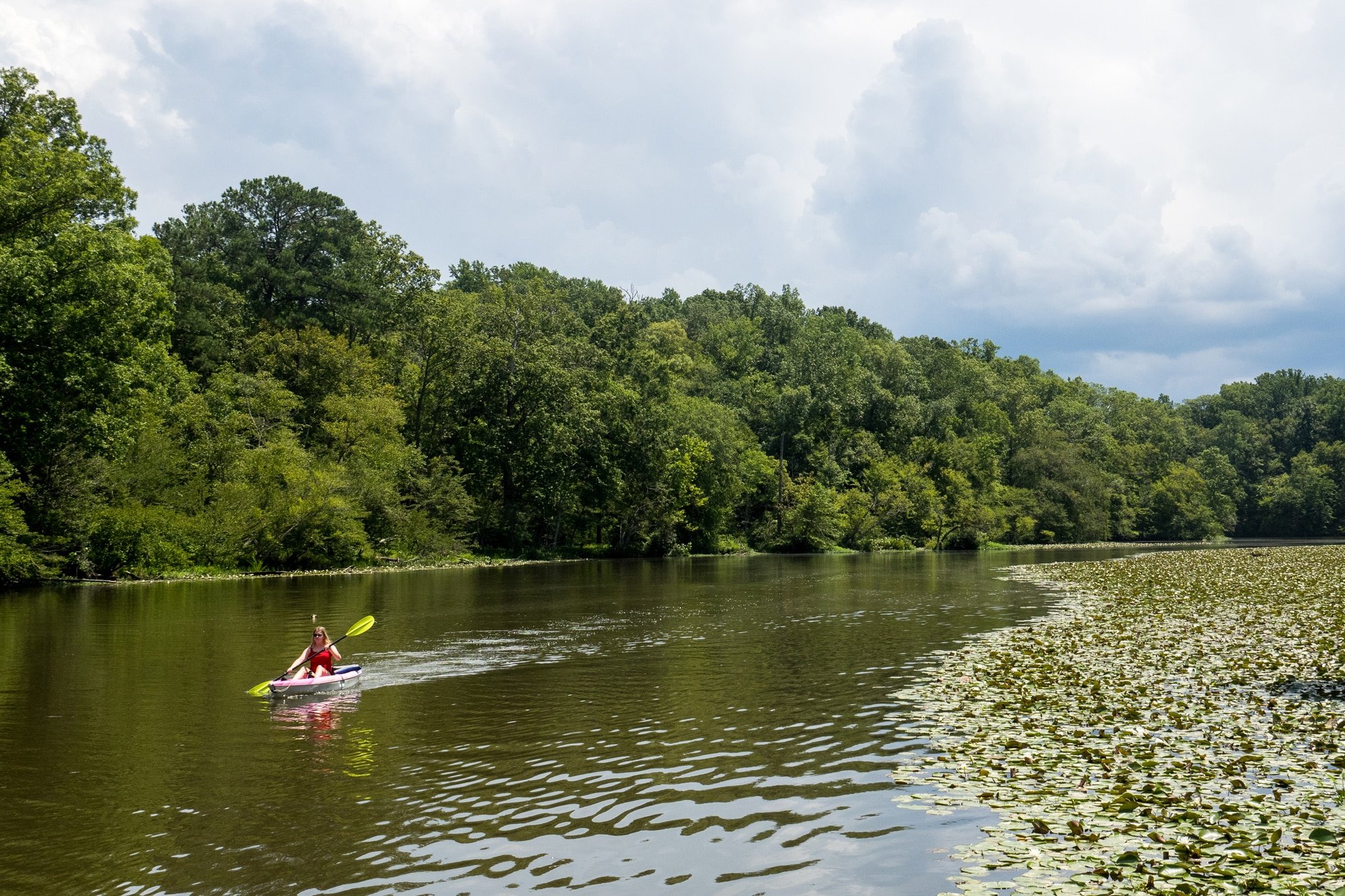
As we re-crossed the bridge, we saw two kayakers exploring the lake. Meanwhile, billowing clouds were filling the sky. We made it back to camp at 2pm and cranked up the camper AC to cool down during lunch. An hour later, a massive rainstorm hit that would close the trails for the rest of our stay. Luckily, there was plenty else to do around the area.
Out and About Around Richmond
After our mountain biking day, we were definitely going out. We started at a nearby brewery, Steam Bell Beer Works. My wife had a refreshing Blood Orange Seltzer, while I went with a solid Hop and Stomp Hazy IPA. Then we spoiled ourselves with her favorite type of food, a great meal at Pakwaan Indian Cuisine.
Another evening, we walked the paths at Belle Island in the James River, which is reached via a walking bridge. There was clearly more to do in Richmond, including mountain biking at the urban James River Park, which we’d have to check out next time. For dinner that night, we stayed closer to camp with a solid meal at El Caporal Mexican Restaurant.
“This salsa is awesome,” I told our young server.
She’d admitted to being overwhelmed by her first week on the job, so we were trying to cheer her up. She nodded eagerly, and then thought about it further.
“But I really only like it when I’m eating it. Not when I’m carrying it around.”
“I can understand that,” I said, dipping another chip.

Colonial National Historical Park
On our last full day in town, we took a trip out to Colonial National Historical Park. It’s located on the Virginia Peninsula, which extends east from Richmond into Chesapeake Bay. The highlight is Historic Jamestowne, the site of the first surviving English colony in the U.S.
A little over an hour’s drive led us to the NPS visitor center, which co-manages the waterfront archeological park along with Preservation Virginia. It’s important to note that Historic Jamestown is different from the adjacent Jamestowne Settlement, which is a state-managed living history museum with a recreated townsite populated by actors in period dress.
We opted for the authentic site, Historic Jamestown, which includes walking paths through original ruins, recreated structures, and restored buildings like the redbrick Jamestown Church. The fascinating Voorhees Archaearium is an onsite archeology museum that displays excavated artifacts and exhibits about the settlement.
Established in 1607, Jamestown would become infamous for its early record of conflict, death, and starvation. Salvation for the precarious settlement would seemingly come from a young Powhatan girl nicknamed Pocahontas. She became a legendary figure in American history for allegedly saving English captain John Smith from execution, plus repeatedly delivering food to the malnourished colonists. Later she married English entrepreneur John Rolfe, who cultivated Virginia’s first cash crop, a sweet strain of tobacco that led to over two centuries of rampant plantation slavery.
Another highlight is a five-mile loop drive around Jamestown Island with a short trail to a waterfront point. The drive and hike offer views of a swampy landscape that, in hindsight, was a terrible choice for settlement. These buggy and soggy lands were hard to farm and surrounded by brackish waters.
From Jamestown, we drove the 23-mile Colonial Parkway through wetlands and forests to visit two other popular sites. The first was Colonial Williamsburg. This vast living history district is found inland within the small modern city of Williamsburg. Operated by a private foundation, hundreds of buildings from the 17th through 19th centuries have been restored or recreated, with costumed reenactors running tourist shops and providing period demonstrations.
We tend to prefer historic ruins and outdoor museums to reenactment sites, so we went with a suggestion from a friendly local. A pricy ticket gets you inside the buildings, but you can walk outside through the historic district for free. Strolling a few miles around town was definitely enough for us. That said, we could tell they do a fine job here, especially for kids.
Our third stop in the national historic park was Yorktown Battlefield, an NPS unit next to the York River at the eastern end of Colonial Parkway. This is the location of the 1781 Siege of Yorktown, where George Washington and the Continental Army secured a decisive victory against the British during the American Revolution. In addition to a small museum, a driving loop leads through the battlefield.
Due to time, we decided to skip the nearby state-managed American Revolution Museum, which combines indoor and outdoor history exhibits with reenactment zones. It does sound interesting, and entry is available as a combo ticket with Colonial Williamsburg and Jamestowne Settlement.
As we drove back to camp, we did our normal recap of what we’d seen. We’d long wanted to see these U.S. historic landmarks. That box was ticked. Now we were excited about our next stop in the mountains. But the rolling hills of Pocahontas State Park would be at the top of our minds the next time we drove north on I-95.
Cover Photo: Paddling in Swift Creek Lake, at Pocahontas State Park. Photo by Mike Bezemek


